All Images
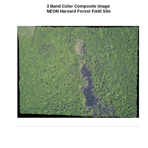
Introduction to Raster Data
Figure 1
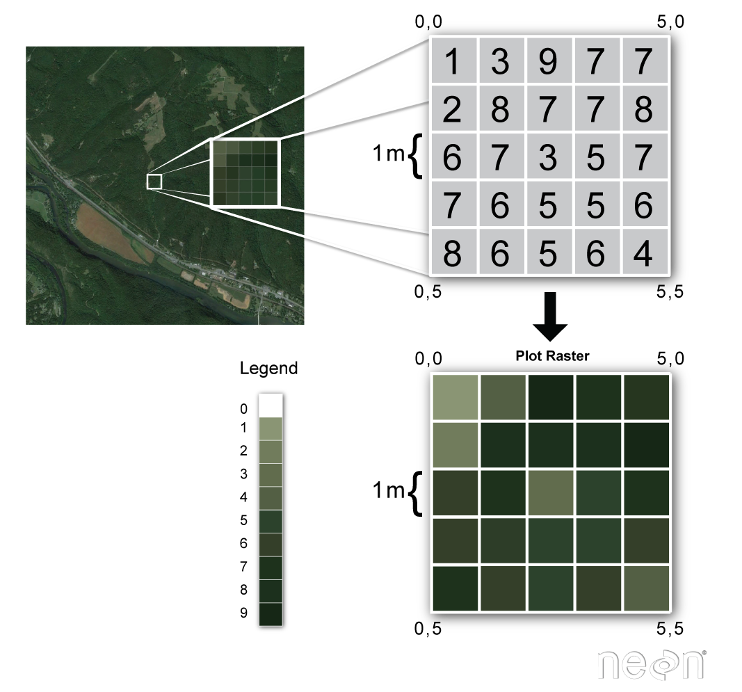
Figure 2
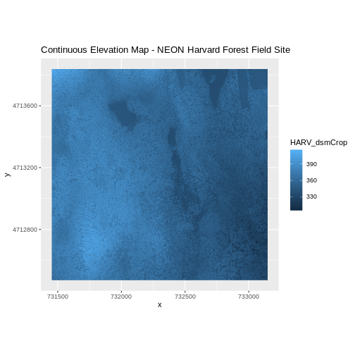
Figure 3
Figure 4
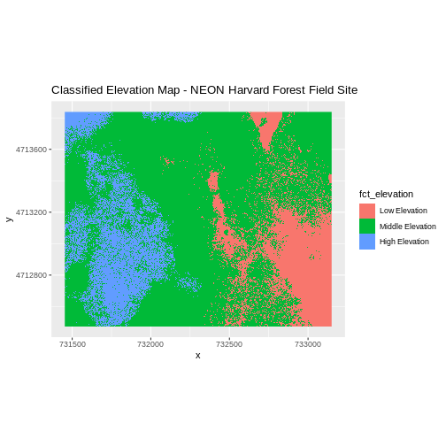
Figure 5
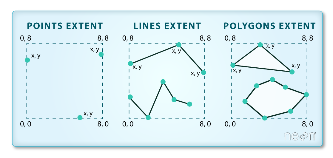
Figure 6
Figure 7
Figure 8
Figure 9
Introduction to Vector Data
Figure 1
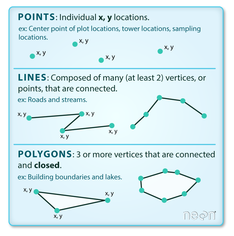
Figure 2
 In the image above, the dashed boxes
around each set of objects seems to imply that the three objects have
the same extent. Is this accurate? If not, which object(s) have a
different extent?
In the image above, the dashed boxes
around each set of objects seems to imply that the three objects have
the same extent. Is this accurate? If not, which object(s) have a
different extent?
Coordinate Reference Systems
Figure 1

Figure 2

Figure 3
Figure 4
